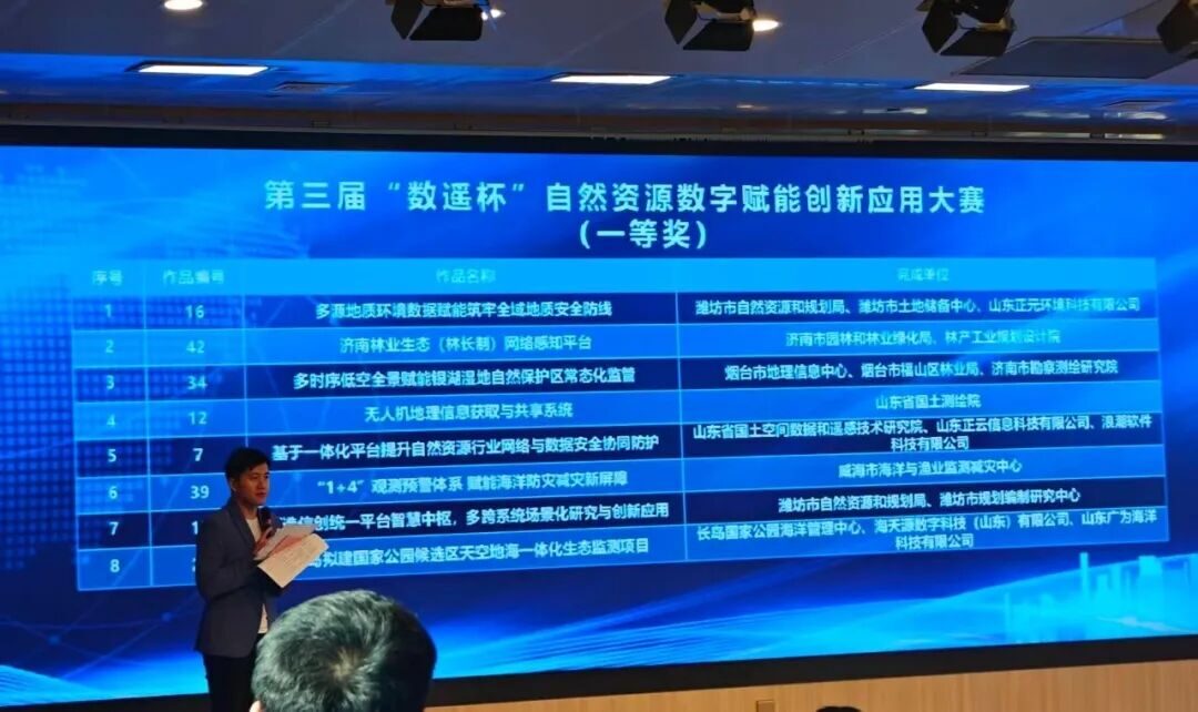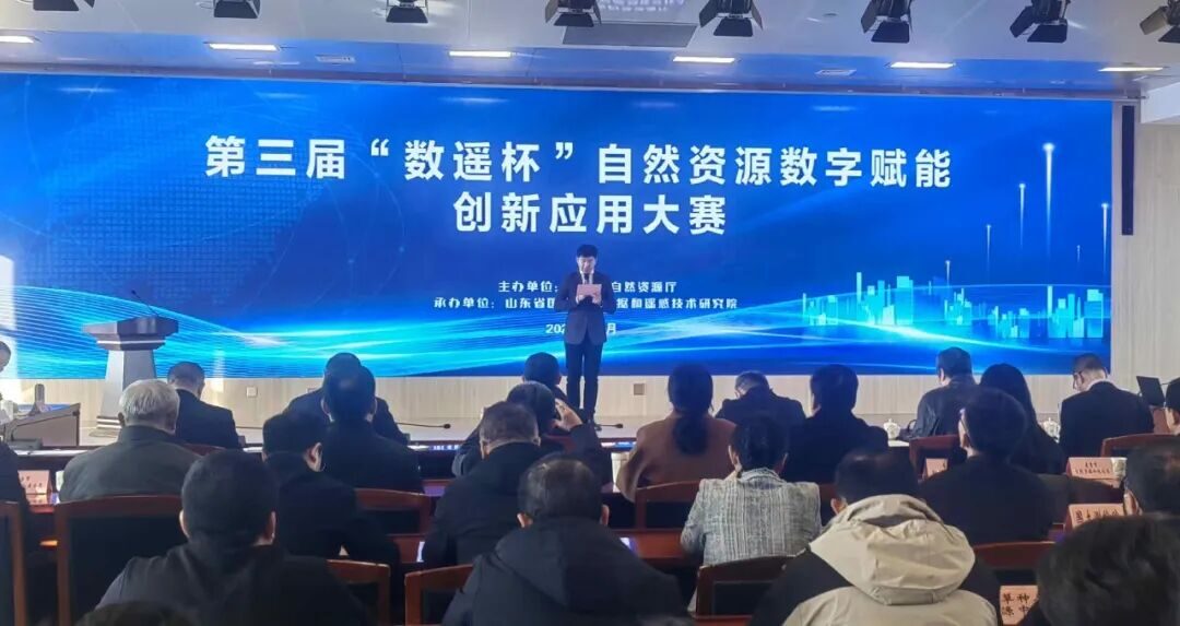
On November 22–23, the finals of Shandong Province’s 3rd "Digital Remote-Sensing Cup" Natural-Resources Digital-Empowerment Innovation Application Competition concluded in Jinan, with a total of 44 entries from across the province reaching the finals. Led by the Changdao National Park Marine Management Center and built with the participation of Shandong Guangwei Marine Technology Co., Ltd., the "Changdao Proposed National Park Candidate Area Sky–Air–Ground–Sea Integrated Ecological Monitoring Project" came through multiple rounds of evaluation, stood out among many excellent provincial entries, and won First Prize.
The "Digital Remote-Sensing Cup" Natural-Resources Digital-Empowerment Innovation Application Competition aims to advance the "one-map" construction of natural-resources management and territorial spatial planning, to create a number of benchmark and exemplary innovation application scenarios, and to form a set of excellent solutions that promote mutual learning.
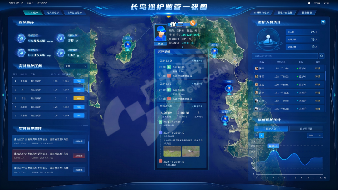
The "Changdao Proposed National Park Candidate Area Sky–Air–Ground–Sea Integrated Ecological Monitoring Project" fully demonstrated the technical highlights and application value of the "sky–air–ground–sea" integrated monitoring system. Its closed-loop, full-chain model of "intelligent perception – algorithmic decision – coordinated handling," together with core advantages such as 95% full-area coverage, 7×24-hour dynamic monitoring, and minute-level emergency response, won high recognition from the review experts.
As a national demonstration of marine-type national-park construction, the project built a sky–air–ground–sea integrated ecological-monitoring system, integrating more than 300 video-surveillance units, 8 shore-based radars, 10 sets of eco-environment monitoring systems, 2 sets of seabed monitoring systems and multiple sets of unattended-UAV systems. Combined with AI recognition and infrared thermal-imaging technology, it achieves intelligent management of species monitoring, illegal-behavior early-warning, marine eco-environment monitoring and cross-departmental joint prevention and control across the 19 islands of Changdao.
During construction, GW-OCEAN integrated seven scenario elements — video surveillance, radar supervision, scientific survey, patrol management, ecological monitoring, resource baseline and unattended systems — to build an intelligent management platform, enabling data sharing across research, conservation and law-enforcement, solving multiple pain points such as numerous monitoring blind spots, limited coverage and low handling timeliness, and providing a replicable, scalable "Changdao experience" for the ecological monitoring and management of island-type protected areas.
This award is not only an affirmation of the project’s technological innovation and application results, but also marks GW-OCEAN’s business extension from ocean digital-intelligence scenarios into the broader field of integrated natural-resources governance, honing a core technology system that covers the full chain of ecological perception, decision-making and handling. In the future, GW-OCEAN will continue to deepen digital-intelligence technology, take marine and fishery business scenarios as its cornerstone, keep opening new space in the digital economy, and contribute more to building a new pattern of intelligent and efficient natural-resources management.