01 / FLAGSHIP
Marine Ranch Management System
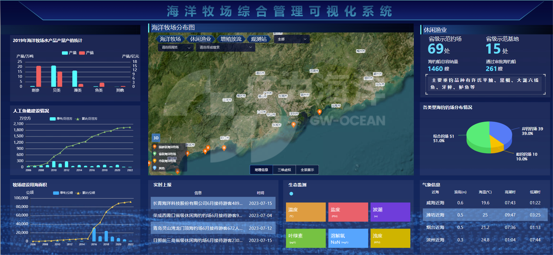
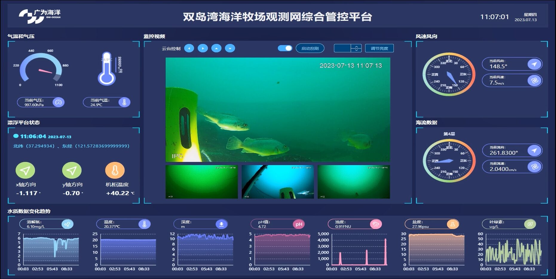
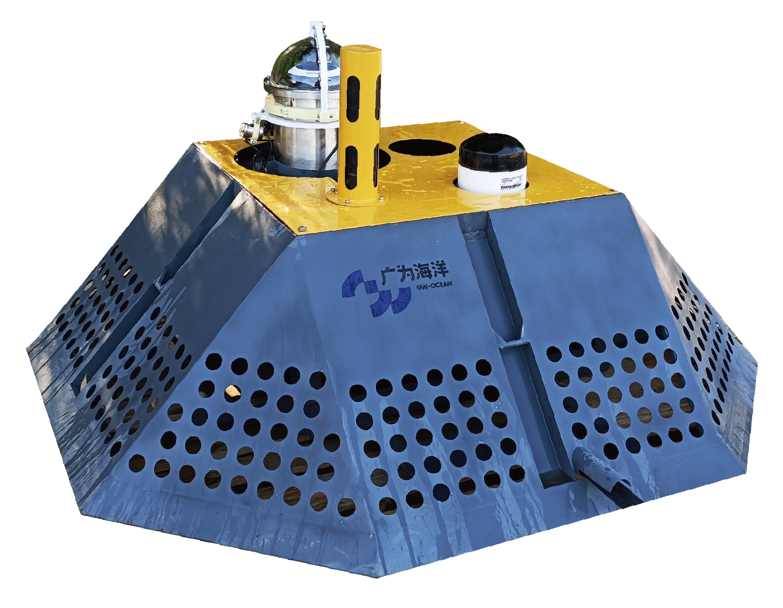
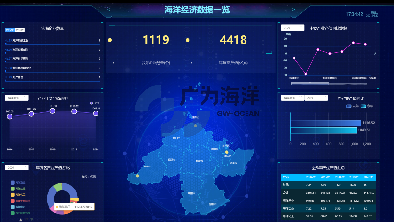
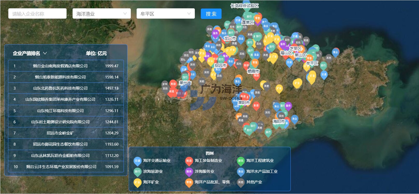
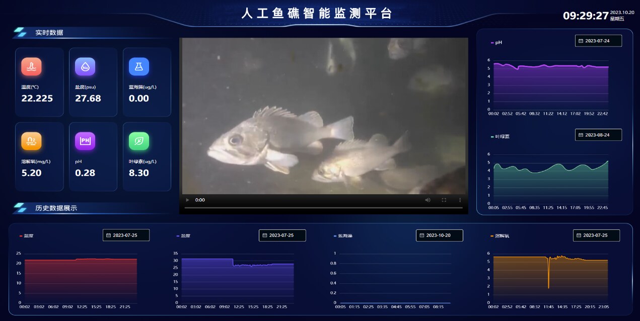
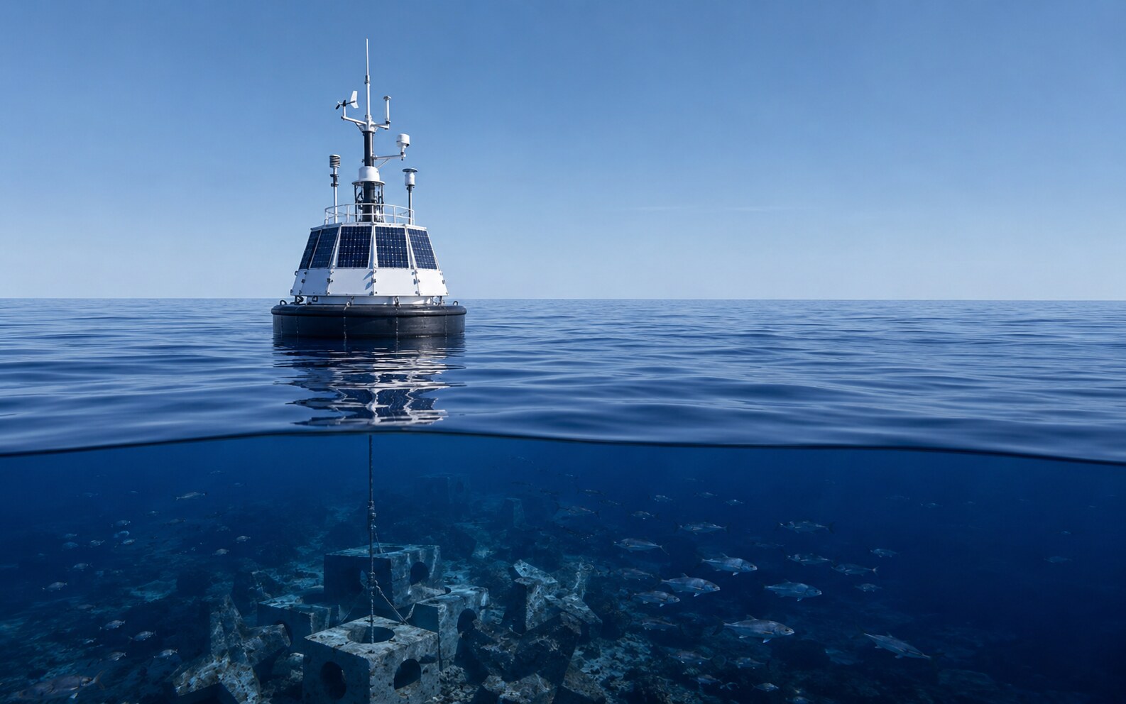
Marine Ranching Management
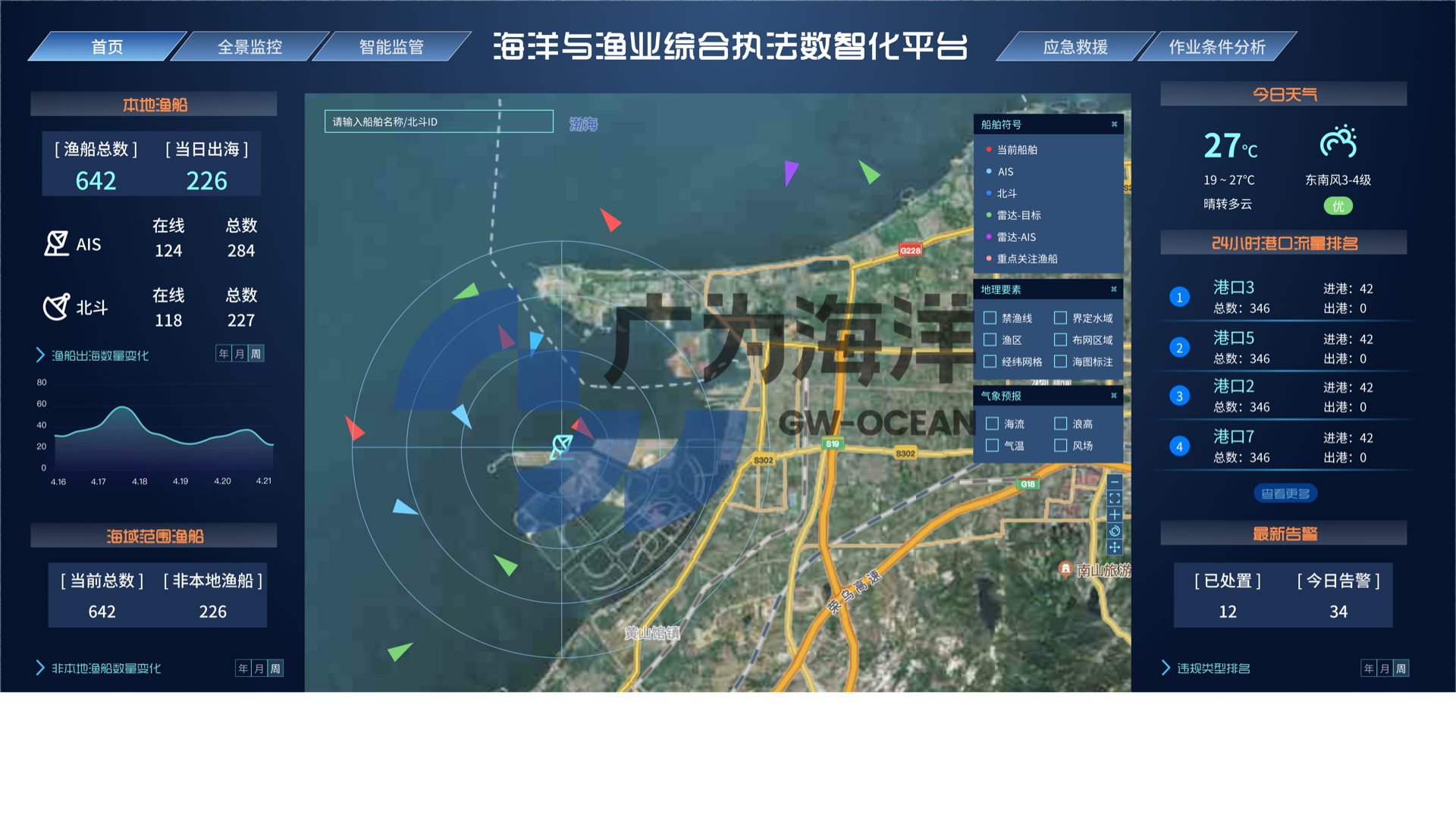
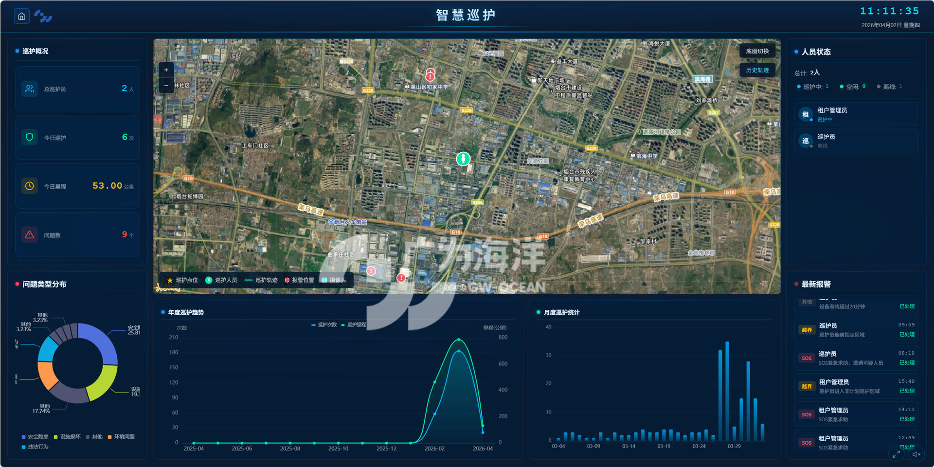
Built on GIS, electronic maps, IoT, cloud computing, 3D visualization and database technologies, and tailored to the characteristics and requirements of marine-ranch construction and management, the system delivers a "single-map" management of integrated marine-ranch information, recreational sea-angling management, stock-enhancement release management, fishery-resource surveys, marine-environment analysis, ecological early warning, 3D virtual display of the marine ranch, and visual command and dispatch.
It provides a full picture of the ecological status, fishery-resource status and production-operation status of marine ranches within the jurisdiction, guiding the scientific implementation of quota-based harvesting and stock-enhancement release. It makes operations information-based, analysis intelligent, early warning timely, dispatch clustered and auxiliary functions interconnected — improving the speed and efficiency of responding to marine ecological disasters, strengthening marine-ranch oversight, and supporting the intelligent upgrade of marine ranches.